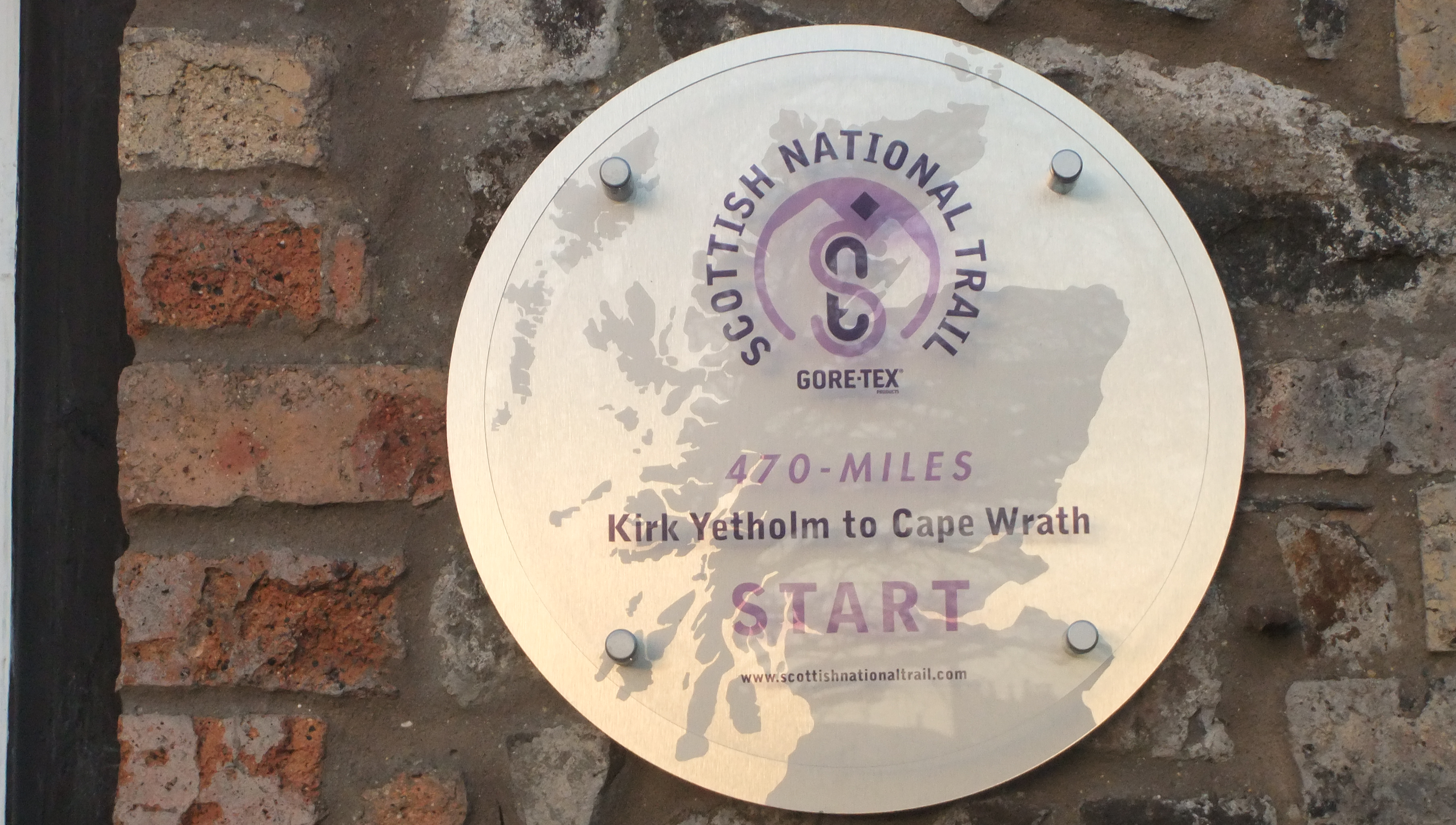
Kirk Yetholm to Cape Wrath
Take 1 – Trying to put together a blog detailing various walks/treks I have done. GS Jan 2014
Inspired by the Cameron McNeish programme, ‘Scotland, End to End, that was shown on BBC Scotland in December 2012, I made a New Year Resolution to try and walk the Scottish National Trail.
I walked the first section from Kirk Yetholm to Ancrum on Saturday the 2nd of March 2013.
Generally speaking the southern sections were easier. That was mainly because you pass through, or close by, lots of towns, so no problem finding accommodation, cash machines, tourist info offices, supplies, transport etc etc.
In terms of walking, the southern section from Kirk Yetholm to Milngavie is a nice, gentle, introduction to the Scottish National Trail and all the more enjoyable for that.
The west coast of Scotland gets way more rain than the East coast. One consequence of this is that the further North west you go, your chances of walking on boggy ground increase. Generally speaking the southern part of the trail had paths that were predominantly dry but some of the paths further North, even when walked in good, dry weather, were occasionally a tad damp underfoot.
Details of each section I walked together with the OS Landranger map numbers, miles walked ( all distances are my estimates) , time taken, accommodation I stayed in etc etc can be found by clicking on the links below.
The routes I walked are detailed below:
Stage 1 – Kirk Yetholm to Milngavie, 143 miles approximately
Kirk Yetholm to Ancrum via Harestanes – 19 miles
http://www.walkhighlands.co.uk/Forum/viewtopic.php?f=9&t=33285&p=198540#p198540
Harestanes to Melrose – 15 miles
http://www.walkhighlands.co.uk/Forum/viewtopic.php?f=9&t=33287&p=198544#p198544
Melrose to Peebles – 25 miles
http://www.walkhighlands.co.uk/Forum/viewtopic.php?f=9&t=33291&p=198549#p198549
Peebles to Carlops – 16 miles
http://www.walkhighlands.co.uk/Forum/viewtopic.php?f=9&t=33293&p=198552#p198552
Carlops to Water of Leith Visitor Centre, Edinburgh – 14 miles
http://www.walkhighlands.co.uk/Forum/viewtopic.php?f=9&t=33294&p=198557#p198557
Linlithgow to Edinburgh – 21 miles (I took the train to Linlithgow then walked home)
http://www.walkhighlands.co.uk/Forum/viewtopic.php?f=9&t=33295&p=198562#p198562
Falkirk High station to Linlithgow – 9 miles
http://www.walkhighlands.co.uk/Forum/viewtopic.php?f=9&t=33296&p=198563#p198563
Falkirk High station to Milngavie 24 miles
http://www.walkhighlands.co.uk/Forum/viewtopic.php?f=9&t=33299&p=198566#p198566
I started stage 2 of the Scottish National Trail between Milngavie and Invergarry on 29th June 2013. Estimated distance is 163 miles.
At this point, I still no idea how far North I would get this year but as Chairman Mao said, ‘the thousand mile walk starts with the first step.’
This second stage was tougher than the first stage from Kirk Yetholm to Milngavie but was still relatively easy going.
Several reasons for it being slightly tougher; I was getting further away from Edinburgh so was having to check public transport and accommodation which added to the planning and cost. And as you get further north so Scotland becomes more rural, public transport is not as good and in the smaller communities accommodation is more limited. A couple of long sections also had to be walked to take me between towns and stage two introduces you to the Highlands which means more ascent. All added to the challenge and the fun.
The route I took between Milngavie and Invergarry is shown below. Click on the links to get a full report on each section. Enjoy and I hope you find it useful.
Milngavie to Aberfoyle via Gartmore – 22 miles
http://www.walkhighlands.co.uk/Forum/viewtopic.php?f=9&t=33607&p=199929#p199929
Aberfoyle to Callander – 10 miles (and one of only 2 days it rained on me between Kirk Yetholm and Ullapool 😦 )
http://www.walkhighlands.co.uk/Forum/viewtopic.php?f=9&t=33611&p=199941#p199941
Callander to Invergeldie via Comrie – 20 miles
http://www.walkhighlands.co.uk/Forum/viewtopic.php?f=9&t=34374&p=203460#p203460
Invergeldie to Aberfeldy – 25 miles
http://www.walkhighlands.co.uk/Forum/viewtopic.php?f=9&t=34451&p=203912#p203912
Aberfeldy to Pitlochry – 9 miles
http://www.walkhighlands.co.uk/Forum/viewtopic.php?f=9&t=34464&p=203960#p203960
Pitlochry to Calvine – 13 miles
http://www.walkhighlands.co.uk/Forum/viewtopic.php?f=9&t=36204&p=211639#p211639
Calvine to Dalwhinnie – 19 miles, then Dalwhinnie to Laggan via Glen Truim – 12 miles
http://www.walkhighlands.co.uk/Forum/viewtopic.php?f=9&t=36205&p=211640#p211640
Laggan to Fort Augustus – 25 miles
http://www.walkhighlands.co.uk/Forum/viewtopic.php?f=9&t=36206&p=211643#p211643
Fort Augustus to Invergarry – 8 miles (The only other day I encountered rain 😦 )
http://www.walkhighlands.co.uk/Forum/viewtopic.php?f=9&t=36498&p=212860#p212860
Stage 3 of my Scottish National Trail jaunt saw me meander through some fantastic country between Invergarry and Ullapool. Distance walked from Invergarry to Ullapool was approximately 116 miles. And all in dry weather.
I did the Invergarry to Cluanie Inn stretch on Sunday 29th September; a beautiful day with blue skies, warm sunshine, no midges and views to die for.
A good weather forecast in Mid October saw me make use of annual leave to head back north to spend 5 days walking from the Cluanie Inn to Ullapool. Fantastic, great landscapes, magnificent walking, highly recommend.
This section was the toughest of the three. Not so much in terms of the countryside I was walking through – though the paths were boggier in places than those further south – but the logistics of walking in what even today is a very remote, sparsely populated, part of the country provided challenges.
Accommodation is more limited; cash machines and shops are few and far between and opening hours of the few shops can be restricted compared to those in larger towns and public transport is sparse. I arrived at Kinlochewe on Sunday 13th October about 3pm. By that time the shops in Kinlochewe had already closed for the day. Wasn’t all bad news as the Kinlochewe Hotel was open and they serve good food and have a decent range of ales.
For stage 3, planning ahead was essential.
Stayed in a mix of hotels and B and B; the best of which were the Kintail Lodge Hotel and the Dundonnell Hotel. Kintail Lodge Hotel offers budget accommodation in their Trekkers Lodge, big thumbs up from me. Check out http://www.kintaillodgehotel.co.uk/scottishbudgetrooms.html
Walked through some great country, the highlight of which was going from Kinlochewe to Dundonnell through the ‘Great Wilderness’ of Fisherfield. That was epic.
The Falls of Glomach will also live long in the memory, especially the descent.
Another abiding memory will be of how quiet it was. Despite the good weather I never met another walker other than those, at the start of the day, who were heading out the same tracks to go bag a Munro or two. Out on the trail, I was on my own which helped accentuate the sense of wilderness. For most of the time the only noise I heard was from the rutting Deer.
Details of the sections I walked can be viewed at length below.
Invergarry to Cluanie Inn – 23 Miles
http://www.walkhighlands.co.uk/Forum/viewtopic.php?f=9&t=36842&p=214305#p214305
Cluanie Inn to Kintail – 20 miles
http://www.walkhighlands.co.uk/Forum/viewtopic.php?f=9&t=37262&p=216147#p216147
Morvich to Strathcarron via Falls of Glomach – 22 miles
http://www.walkhighlands.co.uk/Forum/viewtopic.php?f=9&t=37298&p=216335#p216335
Strathcarron to Kinlochewe – 17 miles
http://www.walkhighlands.co.uk/Forum/viewtopic.php?f=9&t=37299&p=216339#p216339
Kinlochewe to Corrie Hallie and Dundonnell – 20 miles
http://www.walkhighlands.co.uk/Forum/viewtopic.php?f=9&t=37305&p=216358#p216358
Dundonnell to Ullapool – 14 miles
http://www.walkhighlands.co.uk/Forum/viewtopic.php?f=9&t=37307&p=216367#p216367
